
Main menu
You are here
GEoRG FLP
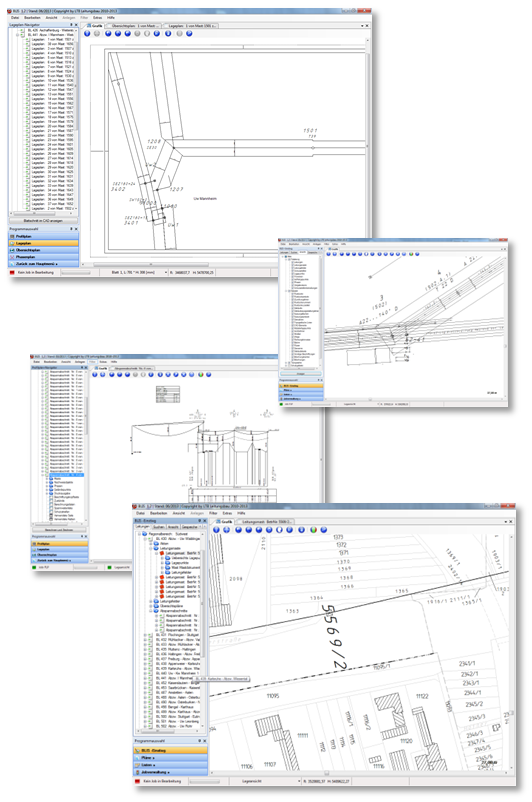
GEoRG FLP is a database-based application for overhead line planning and documentation. It offers outstanding flexibility, performance and user friendliness.
The main functions of GEoRG FLP:
- Geographical and topological mapping of your overhead transmission networks
- Presentation of the planning results
- Clear display of plant data
- Planning of building work
- Changing inventory data using long-term transactions (job concept)
- Profile plans, site plans and layout plans
- Export search results for further processing
- Multi-screen operation for a clear overview
- Filter functions for data analysis
- NAS (standardised exchange interface) for ALKIS data
- Address search using Google Maps API
- Display of the line via Google Earth plug-in
- Display of any WMS services as additional layer
- Hosting of GEoRG FLP data as password-protected WMS service
- Overlay list of the overhead transmission line axis with ESRI shapefiles of the BKG reserve data.
With GEoRG FLP, you have the optimal tool for mapping, planning and expanding your network.